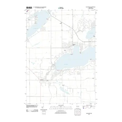
2010 Map of Walworth
USGS Topo · Published 2010About this map
The renowned Yerkes Observatory stands as a primary landmark overlooking the western shores of Lake Geneva in this 2010 topographic record. This portion of Walworth County is defined by its glacial lakes, including the expansive Lake Delavan 36 and the smaller Lake Como. The map highlights a cluster of lakeside communities such as Williams Bay, Fontana, and the inland village of Walworth. Local history and genealogy interest is concentrated at several burial sites, including Union Cemetery, Walworth Center Cemetery, and Cobblestone Cemetery. The landscape is a mix of dense residential development along the shorelines of Point Comfort and Conference Point contrasted with the structured agricultural grid defined by County Hwy-F and Lakeville Rd. This survey documents the modern era of these historic resort and research hubs before more recent expansions.
Find a feature on this map
47 named features on this map. Tap any name to fly to it.
Don’t see what you’re looking for? This feature index may not catch every label — zoom into the map to look around manually.
Map Details
Editions of this 2010 Walworth Map
This is the sole edition of this map. No revisions or reprints were ever made.
Other maps of this area

1893 · Delavan
USGS Topo · 1:62,500

1893 · Geneva
USGS Topo · 1:62,500

1904 · Lake Geneva
USGS Topo · 1:62,500

1906 · Lake Geneva
USGS Topo · 1:62,500

1926 · Mc Henry
USGS Topo · 1:62,500

1932 · Harvard
USGS Topo · 1:48,000

1937 · Harvard
USGS Topo · 1:62,500

1944 · McHenry
USGS Topo · 1:62,500

1954 · Rockford
USGS Topo · 1:250,000

1955 · Rockford
USGS Topo · 1:250,000