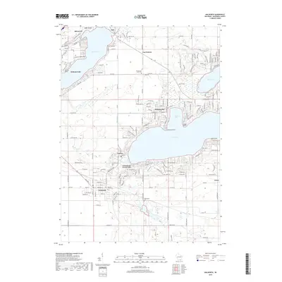
2018 Map of Walworth
USGS Topo · Published 2018About this map
Delavan Lake and Lake Geneva dominate this southeastern Wisconsin landscape, revealing a high-density corridor of summer resorts and year-round communities. The map highlights the clustered development around Williams Bay and Fontana-on-Geneva Lake, where the shoreline is tightly packed with residential streets and institutional landmarks like Conference Point. Inland, the agricultural roots of the region persist near the village of Walworth and the settlement of East Delavan. Local history is anchored by the East Delavan Union Cem and the distinctive Cobblestone Cem, while the course of the White River flows eastward from the lake region. The survey demonstrates how the glacial lakes of Walworth County shaped the transport and settlement patterns of the modern era.
Find a feature on this map
167 named features on this map. Tap any name to fly to it.
Don’t see what you’re looking for? This feature index may not catch every label — zoom into the map to look around manually.
Map Details
Editions of this 2018 Walworth Map
This is the sole edition of this map. No revisions or reprints were ever made.
Other maps of this area

1893 · Delavan
USGS Topo · 1:62,500

1893 · Geneva
USGS Topo · 1:62,500

1904 · Lake Geneva
USGS Topo · 1:62,500

1906 · Lake Geneva
USGS Topo · 1:62,500

1926 · Mc Henry
USGS Topo · 1:62,500

1932 · Harvard
USGS Topo · 1:48,000

1937 · Harvard
USGS Topo · 1:62,500

1944 · McHenry
USGS Topo · 1:62,500

1954 · Rockford
USGS Topo · 1:250,000

1955 · Rockford
USGS Topo · 1:250,000