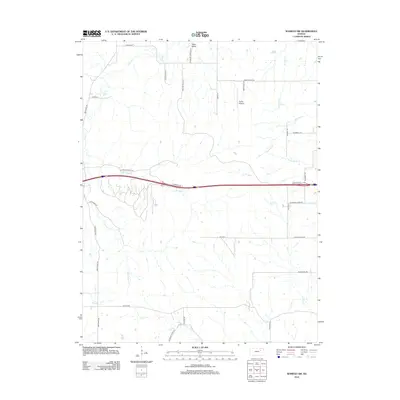
2012 Map of Wamego SW
USGS Topo · Published 2012About this map
Tabor Valley sits at the northern edge of this Riley County landscape, where the prairie is etched by an intricate network of drainage ways. The geography is defined by the convergence of several major tributaries, most notably E Br Deep Cr and S Br Deep Cr, which together carve out the central terrain. This 2012 survey illustrates a rural environment where aviation and agriculture meet at Smith Airport. The road network reflects a history of local land use, featuring routes named for the geography they traverse, such as Hendricks Creek Rd and Pillsbury Crossing Ln. From the flow of Loire Cr in the southeast to the path of Deadman Cr in the southwest, the map provides a precise look at the hydrology of the Flint Hills region at the start of the 2010s.
Find a feature on this map
34 named features on this map. Tap any name to fly to it.
Don’t see what you’re looking for? This feature index may not catch every label — zoom into the map to look around manually.
Map Details
Editions of this 2012 Wamego SW Map
This is the sole edition of this map. No revisions or reprints were ever made.
Other maps of this area

1885 · Eskridge
USGS Topo · 1:125,000

1886 · Junction City
USGS Topo · 1:125,000

1889 · Wamego
USGS Topo · 1:125,000

1889 · Junction City
USGS Topo · 1:125,000

1889 · Parkerville
USGS Topo · 1:125,000

1889 · Eskridge
USGS Topo · 1:125,000

1894 · Eskridge
USGS Topo · 1:125,000

1894 · Junction City
USGS Topo · 1:125,000

1894 · Parkerville
USGS Topo · 1:125,000

1894 · Wamego
USGS Topo · 1:125,000