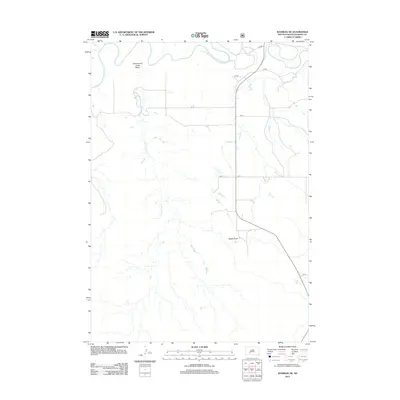
2012 Map of Wanblee NE
USGS Topo · Published 2012About this map
The White River meanders across the northern reaches of this Jackson County landscape, defining the northern boundary of the Cottonwood Creek Basin. This 2012 survey illustrates a sparsely populated region of South Dakota where the drainage of Cottonwood Cr carves through the terrain, leading toward the prominent elevation of Kodak Point. The map reflects a modern rural infrastructure, dominated by a network of sectional roads such as CS 80 and CS 75 that crisscross the plains and breaks south of the river. The lack of concentrated settlements highlights the open, ranching-oriented character of the area during the early 21st century, where land use is primarily dictated by the natural waterways and the rugged breaks of the river basin.
Find a feature on this map
12 named features on this map. Tap any name to fly to it.
Don’t see what you’re looking for? This feature index may not catch every label — zoom into the map to look around manually.
Map Details
Editions of this 2012 Wanblee NE Map
This is the sole edition of this map. No revisions or reprints were ever made.
Other maps of this area

1950 · Wanblee
USGS Topo · 1:24,000

1950 · Weta
USGS Topo · 1:24,000

1951 · Wanblee NW
USGS Topo · 1:24,000

1951 · Pass Creek NW
USGS Topo · 1:24,000

1951 · Kadoka
USGS Topo · 1:24,000

1951 · Belvidere SW
USGS Topo · 1:24,000

1951 · Wanblee NE
USGS Topo · 1:24,000

1955 · Martin
USGS Topo · 1:250,000

1958 · Martin
USGS Topo · 1:250,000

1980 · Kadoka
USGS Topo · 1:100,000