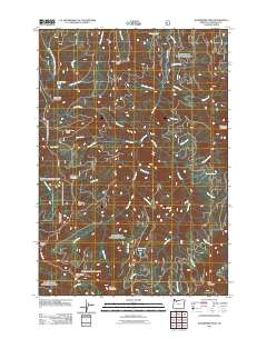
2011 Map of Wanderers Peak
USGS Topo · Published 2011About this map
Wanderers Peak stands as the central landmark in this high-altitude landscape of Clackamas County, defining a region characterized by a complex network of seasonal and perennial waterways. This 2011 survey reveals a terrain where drainage patterns dictate the geography, with the East Fork South Fork Clackamas River and Fish Creek carving deep paths through the timbered slopes. Distinctive peaks such as South Fork Mountain, Fish Creek Mountain, and Dead Horse Butte punctuate the ridges, while smaller water bodies like Memaloose Lake and Surprise Lake are found in the upper basins.
Find a feature on this map
42 named features on this map. Tap any name to fly to it.
Don’t see what you’re looking for? This feature index may not catch every label — zoom into the map to look around manually.
Map Details
Editions of this 2011 Wanderers Peak Map
This is the sole edition of this map. No revisions or reprints were ever made.
Other maps of this area

1916 · Estacada
USGS Topo · 1:125,000

1929 · Mill City
USGS Topo · 1:125,000

1948 · Vancouver
USGS Topo · 1:250,000

1950 · Vancouver
USGS Topo · 1:250,000

1950 · Vancouver
USGS Topo · 1:250,000

1953 · Salem
USGS Topo · 1:250,000

1954 · Salem
USGS Topo · 1:250,000

1955 · Colton
USGS Topo · 1:62,500

1955 · Mill City
USGS Topo · 1:62,500

1956 · Fish Creek Mtn
USGS Topo · 1:62,500