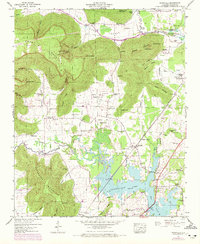
1947 Map of Wannville
USGS Topo · Published 1972About this map
The waters of Guntersville Lake dominate the lowlands of this Jackson County landscape, reflecting the transformation of the Tennessee River valley during the mid-20th century. The boundary of the Guntersville Reservation Boundary winds through a terrain defined by significant ridges like Crow Mountain and Poorhouse Mountain. Small communities such as Fackler and Carns are connected by the Southern Railway and the Lee Highway, which follow the natural contours of the valley floors between the steep slopes of Hammon Ridge and Walker Mountain.
Find a feature on this map
63 named features on this map. Tap any name to fly to it.
Don’t see what you’re looking for? This feature index may not catch every label — zoom into the map to look around manually.
Map Details
Editions of this 1947 Wannville Map
2 editions found
Other maps of this area

1886 · Stevenson
USGS Topo · 1:125,000

1888 · Scottsboro
USGS Topo · 1:125,000

1892 · Scottsboro
USGS Topo · 1:125,000

1892 · Stevenson
USGS Topo · 1:125,000

1895 · Stevenson
USGS Topo · 1:125,000

1936 · Scottsboro
USGS Topo · 1:24,000

1936 · Wannville
USGS Topo · 1:24,000

1936 · Mud Creek
USGS Topo · 1:24,000

1936 · Hytop
USGS Topo · 1:24,000

1936 · Hollywood
USGS Topo · 1:24,000