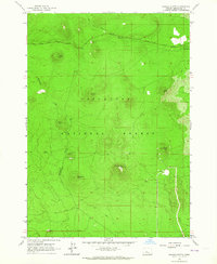
1963 Map of Wanoga Butte
USGS Topo · Published 1964About this map
Wanoga Butte rises as a central landmark in this 1960s study of the high volcanic landscape within the Deschutes National Forest. The map documents a terrain defined by cinder cones and subterranean features, most notably the Edison Ice Cave and several scattered Cinder Pits that suggest the region's geological utility. A Lookout Tower sits atop the primary peak, serving as a vital observation point for forest management during this era.
Find a feature on this map
19 named features on this map. Tap any name to fly to it.
Don’t see what you’re looking for? This feature index may not catch every label — zoom into the map to look around manually.
Map Details
Editions of this 1963 Wanoga Butte Map
2 editions found
Other maps of this area

1926 · Bend
USGS Topo · 1:125,000

1929 · Bend
USGS Topo · 1:125,000

1929 · Three Sisters
USGS Topo · 1:125,000

1930 · Maiden Peak
USGS Topo · 1:125,000

1931 · Newberry Crater
USGS Topo · 1:125,000

1932 · Three Sisters
USGS Topo · 1:125,000

1934 · Maiden Peak
USGS Topo · 1:125,000

1935 · Newberry Crater
USGS Topo · 1:125,000

1955 · Crescent
USGS Topo · 1:250,000

1955 · Bend
USGS Topo · 1:250,000