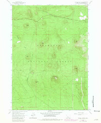
1963 Map of Wanoga Butte
USGS Topo · Published 1981About this map
Volcanic topography dominates this section of the Deschutes National Forest, where a high-elevation landscape is defined by numerous cinder cones and buttes. The Wanoga Butte Lookout Tower stands as a central landmark, overlooking a network of landforms including Kapka Butte, Katalo Butte, and Kiwa Butte. This area, mapped in 1963 and revised in 1981, reflects the region's geological history and its management for both resource extraction and recreation. Notable industrial and natural features such as a Quarry and multiple Cinder Pits appear alongside the Edison Ice Cave, highlighting the unique subterranean lava structures of the Cascades.
Find a feature on this map
19 named features on this map. Tap any name to fly to it.
Don’t see what you’re looking for? This feature index may not catch every label — zoom into the map to look around manually.
Map Details
Editions of this 1963 Wanoga Butte Map
2 editions found
Other maps of this area

1926 · Bend
USGS Topo · 1:125,000

1929 · Bend
USGS Topo · 1:125,000

1929 · Three Sisters
USGS Topo · 1:125,000

1930 · Maiden Peak
USGS Topo · 1:125,000

1931 · Newberry Crater
USGS Topo · 1:125,000

1932 · Three Sisters
USGS Topo · 1:125,000

1934 · Maiden Peak
USGS Topo · 1:125,000

1935 · Newberry Crater
USGS Topo · 1:125,000

1955 · Crescent
USGS Topo · 1:250,000

1955 · Bend
USGS Topo · 1:250,000