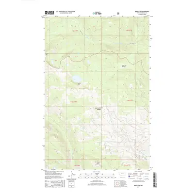
2017 Map of Wapiti Lake
USGS Topo · Published 2017About this map
Mineral Peak and Triangle Peak anchor the high-elevation terrain of Missoula County in this 2017 survey. This portion of the Lolo National Forest is defined by a complex network of drainages and alpine lakes, including the namesake Wapiti Lake and the clustered Farmers Lakes in the southwest. The landscape is carved by the S Fork Jocko River in the north and the upper reaches of Rattlesnake Cr, showcasing a wilderness largely untouched by development. A few primitive routes, such as Finley Creek Rd and Gold Creek Rd, provide limited access to the interior. Notable natural features like Gold Creek Meadows and Boulder Point serve as key landmarks for navigators and researchers studying the high-country topography of the Mission Mountains region.
Find a feature on this map
22 named features on this map. Tap any name to fly to it.
Don’t see what you’re looking for? This feature index may not catch every label — zoom into the map to look around manually.
Map Details
Editions of this 2017 Wapiti Lake Map
This is the sole edition of this map. No revisions or reprints were ever made.
Other maps of this area

1903 · Bonner
USGS Topo · 1:125,000

1921 · Elbow Lake
USGS Topo · 1:125,000

1947 · Butte
USGS Topo · 1:250,000

1955 · Choteau
USGS Topo · 1:250,000

1957 · Choteau
USGS Topo · 1:250,000

1958 · Butte
USGS Topo · 1:250,000

1958 · Choteau
USGS Topo · 1:250,000

1960 · Butte
USGS Topo · 1:250,000

1962 · Choteau
USGS Topo · 1:250,000

1962 · Butte
USGS Topo · 1:250,000