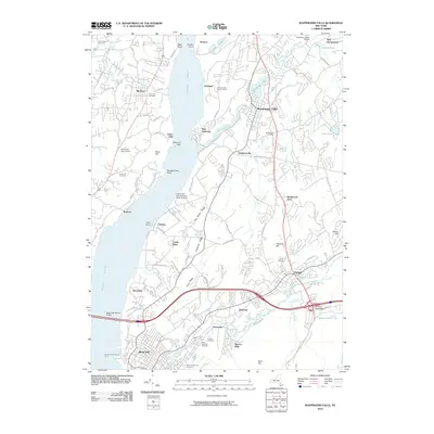
2010 Map of Wappingers Falls
USGS Topo · Published 2010About this map
The Hudson River serves as the central artery for this survey, defining the industrial and residential corridors of Dutchess and Orange Counties. Along its banks, the established settlements of Beacon, Wappingers Falls, and Fishkill anchor the landscape, connected by a dense network of suburban roads and historical landmarks. The infrastructure of the City of New York Delaware Water Supply and the Dutchess County Airport highlights the region's importance as a utility and transportation hub.
Find a feature on this map
88 named features on this map. Tap any name to fly to it.
Don’t see what you’re looking for? This feature index may not catch every label — zoom into the map to look around manually.
Map Details
Editions of this 2010 Wappingers Falls Map
This is the sole edition of this map. No revisions or reprints were ever made.
Other maps of this area

1892 · West Point
USGS Topo · 1:62,500

1893 · Poughkeepsie
USGS Topo · 1:62,500

1894 · West Point
USGS Topo · 1:62,500

1894 · Poughkeepsie
USGS Topo · 1:62,500

1899 · West Point
USGS Topo · 1:62,500

1901 · West Point
USGS Topo · 1:62,500

1902 · Schunemunk
USGS Topo · 1:62,500

1903 · Poughkeepsie
USGS Topo · 1:62,500

1903 · Newburg
USGS Topo · 1:62,500

1930 · Schunemunk
USGS Topo · 1:48,000