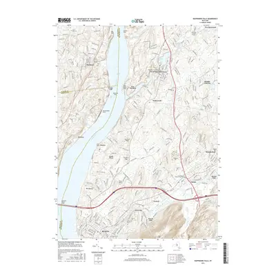
2016 Map of Wappingers Falls
USGS Topo · Published 2016About this map
Hudson River navigation and industrial history anchor this landscape, where the waterway serves as a boundary between Ulster, Dutchess, and Orange counties. The village of Wappingers Falls sits at the confluence of Wappinger Creek and Wappinger Lake, while further south, Beacon and Fishkill demonstrate the continued significance of historic transportation corridors. Prominent terrain features like Beacon Hills and Verplanck Ridge overlook the river, providing a geographical context for the numerous settlements such as New Hamburg, Chelsea, and Glenham. For genealogists, the map is particularly detailed regarding local interments, showing the First Reformed Protestant Dutch Cem, Saint Joachims Cem, and Riverside Cem. The presence of the Dutchess County Airport and the Newburgh-Beacon Bridge highlights the region's mid-century infrastructure and connectivity within the valley.
Find a feature on this map
56 named features on this map. Tap any name to fly to it.
Don’t see what you’re looking for? This feature index may not catch every label — zoom into the map to look around manually.
Map Details
Editions of this 2016 Wappingers Falls Map
This is the sole edition of this map. No revisions or reprints were ever made.
Other maps of this area

1892 · West Point
USGS Topo · 1:62,500

1893 · Poughkeepsie
USGS Topo · 1:62,500

1894 · West Point
USGS Topo · 1:62,500

1894 · Poughkeepsie
USGS Topo · 1:62,500

1899 · West Point
USGS Topo · 1:62,500

1901 · West Point
USGS Topo · 1:62,500

1902 · Schunemunk
USGS Topo · 1:62,500

1903 · Poughkeepsie
USGS Topo · 1:62,500

1903 · Newburg
USGS Topo · 1:62,500

1930 · Schunemunk
USGS Topo · 1:48,000