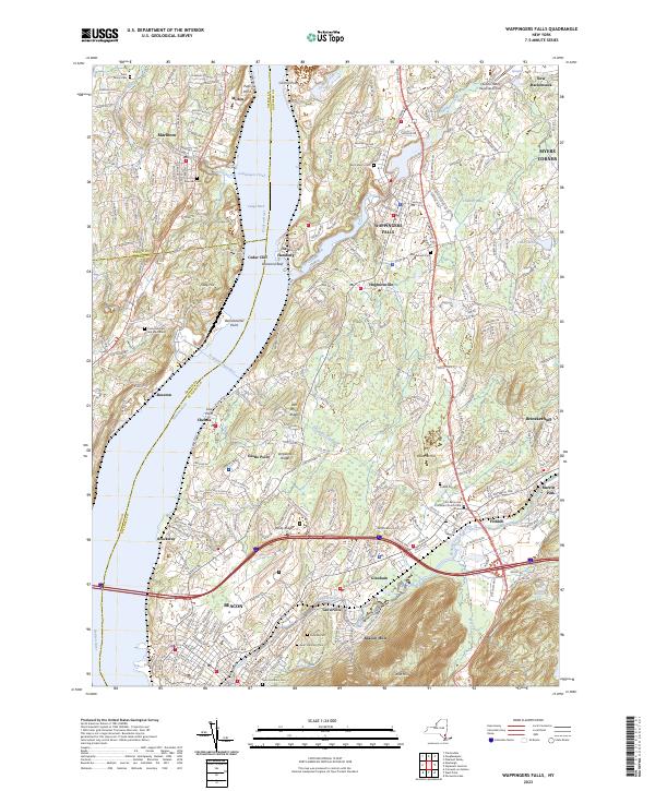
2023 Map of Wappingers Falls
USGS Topo · Published 2023About this map
The Hudson River corridor near Wappingers Falls serves as a vital artery for transport and utility, evidenced by the subterranean path of the Delaware Aqueduct crossing beneath the riverbed. Along the eastern banks, the landscape transitions from industrial nodes at Chelsea and Brockway to the dense residential and commercial grid of Beacon. The terrain is punctuated by significant rises such as Beacon Hills and Bald Hill, while Wappinger Creek carves a path toward the river, passing through the historic centers of Hughsonville and New Hamburg.
Find a feature on this map
55 named features on this map. Tap any name to fly to it.
Don’t see what you’re looking for? This feature index may not catch every label — zoom into the map to look around manually.
Map Details
Editions of this 2023 Wappingers Falls Map
This is the sole edition of this map. No revisions or reprints were ever made.
Other maps of this area

1892 · West Point
USGS Topo · 1:62,500

1893 · Poughkeepsie
USGS Topo · 1:62,500

1894 · West Point
USGS Topo · 1:62,500

1894 · Poughkeepsie
USGS Topo · 1:62,500

1899 · West Point
USGS Topo · 1:62,500

1901 · West Point
USGS Topo · 1:62,500

1902 · Schunemunk
USGS Topo · 1:62,500

1903 · Poughkeepsie
USGS Topo · 1:62,500

1903 · Newburg
USGS Topo · 1:62,500

1930 · Schunemunk
USGS Topo · 1:48,000