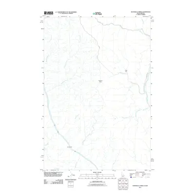
2011 Map of Wapshilla Creek
USGS Topo · Published 2011About this map
The Snake River and Salmon River converge within this rugged landscape, a deep canyon system where the waters define the Idaho-Oregon border. The confluence is a dramatic focal point, flanked by the broad alluvial deposits of Geneva Bar and the steep elevation of Wapshilla Ridge. Access to the interior is limited to a few primitive routes like Zaza Rd and China Creek Rd, which traverse the high ground between the various drainage systems. Numerous water sources dot the canyons, including Hot Spring and Coyote Spring, providing essential landmarks in an area dominated by sharp vertical relief. The network of tributaries, such as Frenchy Creek and Birch Creek, illustrates the complex erosional patterns that have carved this portion of Nez Perce County.
Find a feature on this map
24 named features on this map. Tap any name to fly to it.
Don’t see what you’re looking for? This feature index may not catch every label — zoom into the map to look around manually.
Map Details
Editions of this 2011 Wapshilla Creek Map
This is the sole edition of this map. No revisions or reprints were ever made.
Other maps of this area

1946 · Limekiln Rapids
USGS Topo · 1:62,500

1955 · Pullman
USGS Topo · 1:250,000

1955 · Grangeville
USGS Topo · 1:250,000

1958 · Pullman
USGS Topo · 1:250,000

1959 · Grangeville
USGS Topo · 1:250,000

1963 · Cactus Mtn
USGS Topo · 1:24,000

1963 · Deadhorse Ridge
USGS Topo · 1:24,000

1963 · Jim Creek Butte
USGS Topo · 1:24,000

1963 · Rattlesnake Ridge
USGS Topo · 1:24,000

1963 · Wapshilla Creek
USGS Topo · 1:24,000