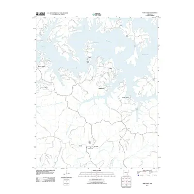
2011 Map of War Eagle
USGS Topo · Published 2011About this map
War Eagle Creek and the expansive White River define this corner of Northwest Arkansas, where the waters of Beaver Lake have reshaped the landscape. Near the southern edge of the map, the War Eagle Bridge and War Eagle Bluff overlook a community steeped in local history, featuring the War Eagle Cemetery and several family burial grounds including Webb Cemetery and Martin Cemetery.
Find a feature on this map
130 named features on this map. Tap any name to fly to it.
Don’t see what you’re looking for? This feature index may not catch every label — zoom into the map to look around manually.
Map Details
Editions of this 2011 War Eagle Map
This is the sole edition of this map. No revisions or reprints were ever made.
Other maps of this area

1899 · Fayetteville
USGS Topo · 1:125,000

1900 · Eureka Springs
USGS Topo · 1:125,000

1901 · Eureka Springs
USGS Topo · 1:125,000

1901 · Fayetteville
USGS Topo · 1:125,000

1904 · Fayetteville
USGS Topo · 1:125,000

1945 · Harrison
USGS Topo · 1:250,000

1949 · Harrison
USGS Topo · 1:250,000

1954 · Harrison
USGS Topo · 1:250,000

1954 · Tulsa
USGS Topo · 1:250,000
1957 · Mundell
USGS Topo · 1:24,000