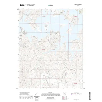
2020 Map of War Eagle
USGS Topo · Published 2020About this map
War Eagle Cr and the sprawling reaches of Beaver Lake dominate this northwest Arkansas landscape, where deep hollows and high ridges dictate the local geography. The settlement of War Eagle is a focal point near the southern edge of the sheet, featuring the prominent War Eagle Bridge and War Eagle Cem. To the north, the community of Larue sits near Cedar Bluff, while Glade occupies the higher ground near the Carroll and Benton county line.
Find a feature on this map
148 named features on this map. Tap any name to fly to it.
Don’t see what you’re looking for? This feature index may not catch every label — zoom into the map to look around manually.
Map Details
Editions of this 2020 War Eagle Map
This is the sole edition of this map. No revisions or reprints were ever made.
Other maps of this area

1899 · Fayetteville
USGS Topo · 1:125,000

1900 · Eureka Springs
USGS Topo · 1:125,000

1901 · Eureka Springs
USGS Topo · 1:125,000

1901 · Fayetteville
USGS Topo · 1:125,000

1904 · Fayetteville
USGS Topo · 1:125,000

1945 · Harrison
USGS Topo · 1:250,000

1949 · Harrison
USGS Topo · 1:250,000

1954 · Harrison
USGS Topo · 1:250,000

1954 · Tulsa
USGS Topo · 1:250,000
1957 · Mundell
USGS Topo · 1:24,000