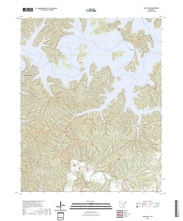
2024 Map of War Eagle
USGS Topo · Published 2024About this map
War Eagle Creek meanders through the southern half of this modern Arkansas landscape, its waters flowing toward the extensive reaches of Beaver Lake to the north. The terrain is defined by deep hollows and narrow ridges, where winding roads like Tomerlin Grist Mill Rd and Slide Off Ridge Rd trace the complex topography of the Ozark foothills. The settlement of War Eagle sits near the namesake War Eagle Bluff, an area historically tied to early milling and river crossings. This 2024 survey captures the modern distribution of small communities such as Larue and Glade, alongside established lakeside developments like Lost Bridge Village. Genealogists and local historians can locate several family and community burial grounds, including War Eagle Cem, Martin Cem, and Rambo Cem, which remain as persistent markers of the region's long-standing residential patterns.
Find a feature on this map
151 named features on this map. Tap any name to fly to it.
Don’t see what you’re looking for? This feature index may not catch every label — zoom into the map to look around manually.
Map Details
Editions of this 2024 War Eagle Map
This is the sole edition of this map. No revisions or reprints were ever made.
Other maps of this area

1899 · Fayetteville
USGS Topo · 1:125,000

1900 · Eureka Springs
USGS Topo · 1:125,000

1901 · Eureka Springs
USGS Topo · 1:125,000

1901 · Fayetteville
USGS Topo · 1:125,000

1904 · Fayetteville
USGS Topo · 1:125,000

1945 · Harrison
USGS Topo · 1:250,000

1949 · Harrison
USGS Topo · 1:250,000

1954 · Harrison
USGS Topo · 1:250,000

1954 · Tulsa
USGS Topo · 1:250,000

1957 · Mundell
USGS Topo · 1:24,000