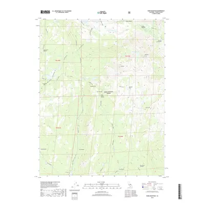
2018 Map of Ward Mountain
USGS Topo · Published 2018About this map
Sierra National Forest occupies this high-elevation landscape, where the S Fork San Joaquin River flows near the northern boundary. The terrain is defined by a series of significant meadows and peaks, including Ward Mtn and Mt Shinn, which tower over numerous alpine water bodies like Ward Mountain Lake and Hobler Lake. This 2018 survey reveals a network of high-country routes such as the Dusy - Ershim and Hot Springs Pass, which likely serve as modern recreational corridors through the wilderness.
Find a feature on this map
42 named features on this map. Tap any name to fly to it.
Don’t see what you’re looking for? This feature index may not catch every label — zoom into the map to look around manually.
Map Details
Editions of this 2018 Ward Mountain Map
This is the sole edition of this map. No revisions or reprints were ever made.
Other maps of this area

1904 · Kaiser
USGS Topo · 1:125,000

1912 · Mt. Goddard
USGS Topo · 1:125,000

1947 · Mariposa
USGS Topo · 1:250,000

1948 · Mariposa
USGS Topo · 1:250,000

1953 · Mt Abbot
USGS Topo · 1:62,500

1953 · Huntington Lake
USGS Topo · 1:62,500

1953 · Blackcap Mtn
USGS Topo · 1:62,500

1953 · Kaiser Peak
USGS Topo · 1:62,500

1957 · Mariposa
USGS Topo · 1:250,000
1962 · Blackcap Mtn
USGS Topo · 1:62,500