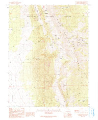
1990 Map of Ward Mountain
USGS Topo · Published 1991About this map
Humboldt National Forest encompasses much of this high-elevation landscape, where the ridges of the Egan Range and Ward Mountain overlook the broad White River Valley. The terrain is marked by a complex network of resource extraction and water management, evidenced by the numerous mining claims concentrated in the northeast near Ward. This area is punctuated by operations such as the Blades Mine, Paymaster Mine, and the Defiance Mine, alongside various prospects and adits that speak to the region's silver and gold prospecting history.
Find a feature on this map
51 named features on this map. Tap any name to fly to it.
Don’t see what you’re looking for? This feature index may not catch every label — zoom into the map to look around manually.
Map Details
Editions of this 1990 Ward Mountain Map
This is the sole edition of this map. No revisions or reprints were ever made.
Other maps of this area

1952 · Ely
USGS Topo · 1:125,000

1956 · Lund
USGS Topo · 1:250,000

1956 · Ely
USGS Topo · 1:250,000

1958 · Comins Lake
USGS Topo · 1:24,000

1958 · Ely
USGS Topo · 1:62,500

1958 · Giroux Wash
USGS Topo · 1:24,000

1958 · Ely
USGS Topo · 1:24,000

1959 · Ely
USGS Topo · 1:250,000

1959 · Preston Reservoir
USGS Topo · 1:62,500

1960 · Lund
USGS Topo · 1:250,000