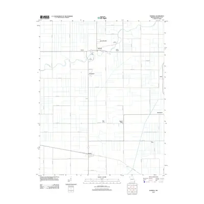
2012 Map of Wardell
USGS Topo · Published 2012About this map
Wardell and its neighboring communities in Pemiscot County are defined by a strictly surveyed grid of drainage ditches and county roads that transformed this section of the Bootheel into productive farmland. The Little River meanders through the northern section, its natural path contrasting with the engineered precision of the surrounding landscape. Small residential clusters and agricultural hubs like North Wardell, Homestown, and Pascola are connected by a network of thoroughfares including Co HWY-218 and Co HWY-244. Genealogy and local history are anchored by several community burial sites, such as the Wardell Memorial Cemetery and Ingram Ridge Cemetery. The map also identifies smaller named locales such as Ewells, Terry, and Netherlands, reflecting the dense settlement pattern of this rural Missouri region.
Find a feature on this map
50 named features on this map. Tap any name to fly to it.
Don’t see what you’re looking for? This feature index may not catch every label — zoom into the map to look around manually.
Map Details
Editions of this 2012 Wardell Map
This is the sole edition of this map. No revisions or reprints were ever made.
Other maps of this area

1939 · Portageville
USGS Topo · 1:62,500

1939 · Caruthersville
USGS Topo · 1:62,500

1940 · Pascola
USGS Topo · 1:62,500

1940 · Hayti
USGS Topo · 1:62,500

1951 · Caruthersville
USGS Topo · 1:62,500

1955 · Pascola
USGS Topo · 1:62,500

1955 · Hayti
USGS Topo · 1:62,500

1955 · Portageville
USGS Topo · 1:62,500

1956 · Dyersburg
USGS Topo · 1:250,000

1957 · Caruthersville
USGS Topo · 1:62,500