2021 Map of Wardell
USGS Topo · Published 2021About this map
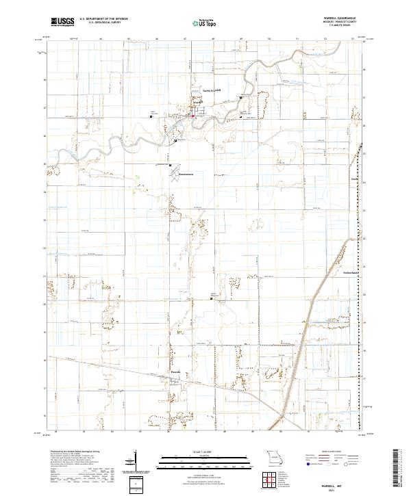
The agricultural landscape of Pemiscot County is defined here by the winding course of the Little River and a sophisticated network of drainage infrastructure, including Ditch Number 67 and Ditch Number 70. This 2021 survey reveals a cluster of settlements north of the river, centered on Wardell and North Wardell, which serve as local hubs for the surrounding farmland. The area is notable for its numerous small burial grounds that dot the countryside, such as Warren Cem, Saint Paul Cem, and Wardell Memorial Cem, providing critical touchpoints for genealogists and local historians.
Find a feature on this map
62 named features on this map. Tap any name to fly to it.
Don’t see what you’re looking for? This feature index may not catch every label — zoom into the map to look around manually.
Map Details
Editions of this 2021 Wardell Map
This is the sole edition of this map. No revisions or reprints were ever made.