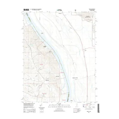
2015 Map of Ware
USGS Topo · Published 2015About this map
The Mississippi River defines this riverine landscape at the border of Illinois and Missouri, where the channel is punctuated by landforms like Vancill Towhead and Swiftsure Towhead. On the eastern bank, the lowland drainage system of Running Lake Ditch and Number 7 Ditch manages the floodplain near Ware and Wolf Lake. To the west, the terrain rises into the hills of Cape Girardeau County, Missouri, where the small community of Egypt Mills and the historic river access at Moccasin Springs are situated.
Find a feature on this map
63 named features on this map. Tap any name to fly to it.
Don’t see what you’re looking for? This feature index may not catch every label — zoom into the map to look around manually.
Map Details
Editions of this 2015 Ware Map
This is the sole edition of this map. No revisions or reprints were ever made.
Other maps of this area

1918 · Altenburg
USGS Topo · 1:62,500

1920 · Jonesboro
USGS Topo · 1:62,500

1922 · Cape Girardeau
USGS Topo · 1:62,500

1923 · Jonesboro
USGS Topo · 1:62,500

1924 · Cape Girardeau
USGS Topo · 1:62,500

1924 · Alto Pass
USGS Topo · 1:62,500

1925 · Altenburg
USGS Topo · 1:62,500

1947 · Jonesboro
USGS Topo · 1:62,500

1947 · Alto Pass
USGS Topo · 1:62,500

1947 · Mc Clure
USGS Topo · 1:24,000