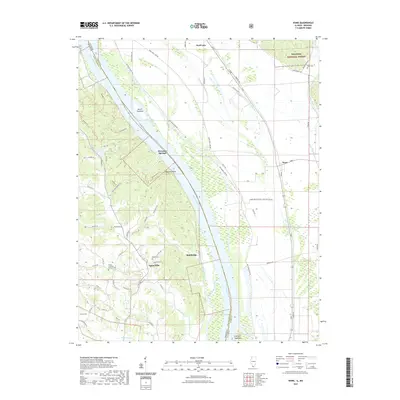
2021 Map of Ware
USGS Topo · Published 2021About this map
Egypt Mills sits at the foot of the bluffs overlooking the Mississippi River bottomlands, marking a transition between the rugged forested hills and the fertile alluvial plain. This area of the border between Illinois and Missouri is defined by extensive drainage engineering, including the Running Lake Ditch and Number 7 Ditch, which manage the water levels of the low-lying fields. The settlement of Ware acts as a small hub for the rural community, situated near the Shawnee National Forest boundary. Researchers will find significant genealogical sites such as Trinity Lutheran Church Cem and Keyser Cem. The river geography is notably dynamic, featuring named islands and bars like Vancill Towhead and Swiftshore Towhead, while inland recreational spots like Lake Boutin provide contrast to the agricultural and industrial drainage network.
Find a feature on this map
80 named features on this map. Tap any name to fly to it.
Don’t see what you’re looking for? This feature index may not catch every label — zoom into the map to look around manually.
Map Details
Editions of this 2021 Ware Map
This is the sole edition of this map. No revisions or reprints were ever made.
Other maps of this area

1918 · Altenburg
USGS Topo · 1:62,500

1920 · Jonesboro
USGS Topo · 1:62,500

1922 · Cape Girardeau
USGS Topo · 1:62,500

1923 · Jonesboro
USGS Topo · 1:62,500

1924 · Cape Girardeau
USGS Topo · 1:62,500

1924 · Alto Pass
USGS Topo · 1:62,500

1925 · Altenburg
USGS Topo · 1:62,500

1947 · Jonesboro
USGS Topo · 1:62,500

1947 · Alto Pass
USGS Topo · 1:62,500

1947 · Mc Clure
USGS Topo · 1:24,000