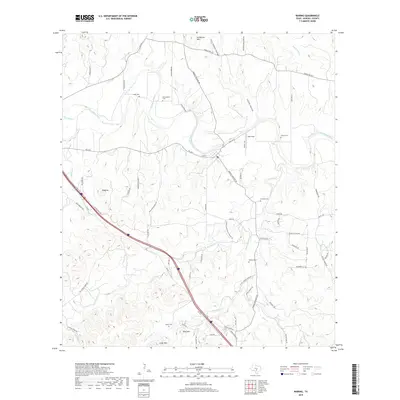
2019 Map of Waring
USGS Topo · Published 2019About this map
The Guadalupe River carves a winding path through this portion of Kendall County, serving as a primary geographical anchor for the surrounding Hill Country terrain. The landscape is defined by significant elevations such as Schleicher Mtn, Ring Mtn, and Cedar Mtn, interspersed with deep drainage features like First Coffee Hollow and Second Coffee Hollow. Settlement patterns are largely rural, centered around ranching roads and small locales like Jungfrau and Rust Field.
Find a feature on this map
67 named features on this map. Tap any name to fly to it.
Don’t see what you’re looking for? This feature index may not catch every label — zoom into the map to look around manually.
Map Details
Editions of this 2019 Waring Map
This is the sole edition of this map. No revisions or reprints were ever made.
Other maps of this area

1894 · Fredericksburg
USGS Topo · 1:125,000

1954 · Llano
USGS Topo · 1:250,000

1954 · San Antonio
USGS Topo · 1:250,000

1955 · Llano
USGS Topo · 1:250,000

1956 · Comfort
USGS Topo · 1:62,500

1956 · Llano
USGS Topo · 1:250,000

1957 · Boerne
USGS Topo · 1:62,500

1957 · San Antonio
USGS Topo · 1:250,000

1963 · Whitworth Ranch
USGS Topo · 1:24,000

1964 · Comfort
USGS Topo · 1:24,000