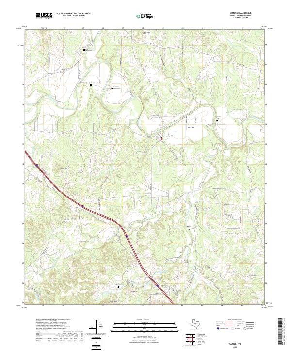
2022 Map of Waring
USGS Topo · Published 2022About this map
The Guadalupe River carves a winding path through this portion of the Texas Hill Country, defining a landscape of deeply etched drainages and prominent rises. Local family history is etched into the land through numerous small burial sites, including the Rose Family Cem, Insall Cem, and Zoeller Cem, which suggest the lineage of early ranching and farming settlements. The terrain is marked by distinctive elevations such as Schleicher Mtn and Ring Mtn, while the complex drainage system of First Coffee Hollow and Coffee Hollow feeds into the main river valley.
Find a feature on this map
75 named features on this map. Tap any name to fly to it.
Don’t see what you’re looking for? This feature index may not catch every label — zoom into the map to look around manually.
Map Details
Editions of this 2022 Waring Map
This is the sole edition of this map. No revisions or reprints were ever made.
Other maps of this area

1894 · Fredericksburg
USGS Topo · 1:125,000

1954 · Llano
USGS Topo · 1:250,000

1954 · San Antonio
USGS Topo · 1:250,000

1955 · Llano
USGS Topo · 1:250,000

1956 · Comfort
USGS Topo · 1:62,500

1956 · Llano
USGS Topo · 1:250,000

1957 · Boerne
USGS Topo · 1:62,500

1957 · San Antonio
USGS Topo · 1:250,000

1963 · Whitworth Ranch
USGS Topo · 1:24,000

1964 · Comfort
USGS Topo · 1:24,000