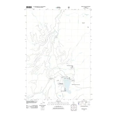
2011 Map of Warm Lake
USGS Topo · Published 2011About this map
Warm Lake serves as the focal point of this mountainous Idaho landscape, surrounded by a cluster of seasonal residential zones including the Paradise Valley Summer Home Area and Kinney Point Summer Home Area. The area's recreational development is evident through numerous facilities such as the Shoreline Campground and the Warm Lake Shoreline Boat Ramp, reflecting a long-standing tradition of lakeside retreats in Valley County.
Find a feature on this map
43 named features on this map. Tap any name to fly to it.
Don’t see what you’re looking for? This feature index may not catch every label — zoom into the map to look around manually.
Map Details
Editions of this 2011 Warm Lake Map
This is the sole edition of this map. No revisions or reprints were ever made.
Other maps of this area

1954 · Gold Fork
USGS Topo · 1:62,500

1954 · Warm Lake
USGS Topo · 1:62,500

1957 · Challis
USGS Topo · 1:250,000

1960 · Challis
USGS Topo · 1:250,000

1963 · Challis
USGS Topo · 1:250,000

1973 · Blackmare
USGS Topo · 1:24,000

1973 · White Rock Peak
USGS Topo · 1:24,000
1973 · Log Mountain
USGS Topo · 1:24,000

1982 · Pistol Creek
USGS Topo · 1:100,000
1988 · Gold Fork Rock
USGS Topo · 1:24,000