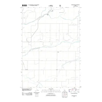
2011 Map of Warm River
USGS Topo · Published 2011About this map
Henrys Fork and the Warm River confluence anchor the northern landscape of this Fremont County quadrangle, where the river system transitions from recreation at the Warm River Campground to a sophisticated agricultural water network. The terrain is defined by an extensive series of irrigation projects, including the Yellowstone Canal, North Lateral Marysville Canal, and the Farmers Own Canal, which draw from the Fall River to support the high-altitude farming operations. Small rural communities and agricultural junctions like Squirrel and Grainville are connected by a rigid grid of section roads, such as Grainville Rd and Marysville Rd. For family historians, the Squirrel Cemetery remains a central landmark in this corner of Idaho, while Stephens Fish Creek Ranch and Pops Dam reflect the private land holdings and water management structures that have shaped the local economy and geography since the early 20th century.
Find a feature on this map
39 named features on this map. Tap any name to fly to it.
Don’t see what you’re looking for? This feature index may not catch every label — zoom into the map to look around manually.
Map Details
Editions of this 2011 Warm River Map
This is the sole edition of this map. No revisions or reprints were ever made.
Other maps of this area

1955 · Ashton
USGS Topo · 1:250,000

1955 · Driggs
USGS Topo · 1:250,000

1957 · Warm River Butte
USGS Topo · 1:62,500

1958 · Driggs
USGS Topo · 1:250,000

1958 · Ashton
USGS Topo · 1:250,000

1960 · Ashton
USGS Topo · 1:250,000

1962 · Driggs
USGS Topo · 1:250,000

1965 · Lamont
USGS Topo · 1:24,000

1965 · Ashton
USGS Topo · 1:24,000

1965 · Lookout Butte
USGS Topo · 1:24,000