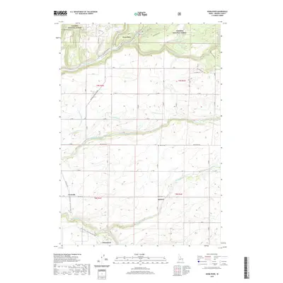
2020 Map of Warm River
USGS Topo · Published 2020About this map
Henrys Fork and the Warm River converge in the northern portion of this Fremont County landscape, where the Targhee National Forest meets the developed agricultural lands of eastern Idaho. The region’s transformation is visible through an extensive network of irrigation infrastructure, including the Yellowstone Canal, Marysville Canal, and Farmers Own Canal. These systems support a cluster of small rural settlements such as Squirrel, Grainville, and Drummond, many of which grew around the regional transportation corridors. Modern recreation and heritage conservation are evident in the Yellowstone / Grand Teton Rail Trail, which follows the historic path of the railroad across the southern half of the map. Tracing the route of the Mesa Falls Scenic Byway reveals how the topography shifts from the canyon depths of Hale Canyon to the structured grid of rural roads like Squirrel Rd.
Find a feature on this map
43 named features on this map. Tap any name to fly to it.
Don’t see what you’re looking for? This feature index may not catch every label — zoom into the map to look around manually.
Map Details
Editions of this 2020 Warm River Map
This is the sole edition of this map. No revisions or reprints were ever made.
Other maps of this area

1955 · Ashton
USGS Topo · 1:250,000

1955 · Driggs
USGS Topo · 1:250,000

1957 · Warm River Butte
USGS Topo · 1:62,500

1958 · Driggs
USGS Topo · 1:250,000

1958 · Ashton
USGS Topo · 1:250,000

1960 · Ashton
USGS Topo · 1:250,000

1962 · Driggs
USGS Topo · 1:250,000

1965 · Lamont
USGS Topo · 1:24,000

1965 · Ashton
USGS Topo · 1:24,000

1965 · Lookout Butte
USGS Topo · 1:24,000