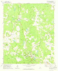
1971 Map of Warm Springs
USGS Topo · Published 1973About this map
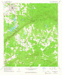
The Little White House and the Warm Springs Foundation anchor this 1970s landscape, reflecting the area's significance as a center for rehabilitation and a presidential retreat. The terrain is marked by the geological convergence of the Warm Springs themselves and the flowing waters of Sulphur Creek and Cold Spring Branch. Small rural communities and crossroads such as Harris City, Kendal, and Raleigh are connected by a network of railroads, including the Central of Georgia and the Seaboard Coast Line. Local history is preserved in the numerous family and community landmarks, from the Judson-Bulloch Cem to Cedar Rock Ch. The map also captures specialized land uses of the era, such as the Warm Springs National Fish Hatchery and the Roosevelt Memorial Airport, illustrating a region where public health infrastructure and agriculture met mid-century transit.
Find a feature on this map
60 named features on this map. Tap any name to fly to it.
Don’t see what you’re looking for? This feature index may not catch every label — zoom into the map to look around manually.
Map Details
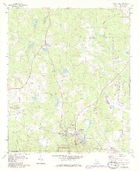
Editions of this 1971 Warm Springs Map
2 editions found
Other maps of this area

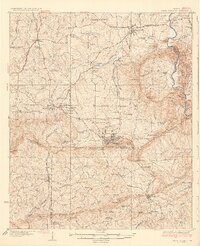
1907 · Talbotton
USGS Topo · 1:125,000
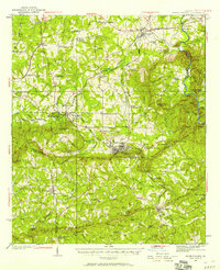
1934 · Warm Springs
USGS Topo · 1:62,500
1936 · Warm Springs
USGS Topo · 1:62,500

1953 · Atlanta
USGS Topo · 1:250,000

1955 · Phenix City
USGS Topo · 1:250,000

1957 · Phenix City
USGS Topo · 1:250,000

1957 · Atlanta
USGS Topo · 1:250,000

1958 · Phenix City
USGS Topo · 1:250,000

1958 · Atlanta
USGS Topo · 1:250,000
1964 · Pine Mountain
USGS Topo · 1:24,000