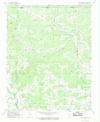
1967 Map of Warm Springs
USGS Topo · Published 1969About this map
Warm Springs serves as the focal point of this 1960s survey along the Missouri-Arkansas state line, where the topography of Ripley and Randolph counties transitions into a landscape defined by natural springs and winding creek beds. The area is characterized by a high density of small rural communities and named landmarks like Hamil and Ingram, alongside several country churches such as Macedonia Ch and Blackwell Den Ch.
Find a feature on this map
51 named features on this map. Tap any name to fly to it.
Don’t see what you’re looking for? This feature index may not catch every label — zoom into the map to look around manually.
Map Details
Editions of this 1967 Warm Springs Map
2 editions found
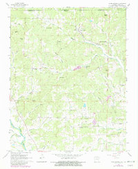
Other maps of this area

1935 · Reyno
USGS Topo · 1:62,500

1939 · Doniphan
USGS Topo · 1:62,500

1941 · Gatewood
USGS Topo · 1:62,500

1945 · Doniphan
USGS Topo · 1:62,500

1945 · Gatewood
USGS Topo · 1:62,500

1957 · Poplar Bluff
USGS Topo · 1:250,000

1959 · Poplar Bluff
USGS Topo · 1:250,000

1960 · Poplar Bluff
USGS Topo · 1:250,000

1965 · Gatewood
USGS Topo · 1:24,000

1966 · Ravenden Springs
USGS Topo · 1:24,000