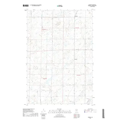
2019 Map of Warman
USGS Topo · Published 2019About this map
Warman and Woodland serve as the primary hubs of this Kanabec County landscape, where the drainage patterns of central Minnesota define the rural layout. The terrain is characterized by the convergence of the Knife River and the Snake River in the southern reaches, while Snowshoe Brook meanders through the eastern sections. A dense grid of local roads, such as Mcgrew Rd and Peterson Rd, connects scattered homes and agricultural plots, reflecting a settlement pattern deeply tied to the land's hydrology. The presence of Bean Brook and Hay Cr further underscores the water-rich environment, which likely influenced the historical placement of early homesteads and roads. Researchers can trace the section lines and township boundaries, such as t41n r23w, which provide a clear framework for identifying property locations and geographical context within Ford Township.
Find a feature on this map
39 named features on this map. Tap any name to fly to it.
Don’t see what you’re looking for? This feature index may not catch every label — zoom into the map to look around manually.
Map Details
Editions of this 2019 Warman Map
This is the sole edition of this map. No revisions or reprints were ever made.
Other maps of this area

1953 · Duluth
USGS Topo · 1:250,000

1953 · Stillwater
USGS Topo · 1:250,000

1955 · Stillwater
USGS Topo · 1:250,000

1958 · Stillwater
USGS Topo · 1:250,000

1958 · Duluth
USGS Topo · 1:250,000

1961 · Brook Park
USGS Topo · 1:62,500

1965 · Stillwater
USGS Topo · 1:250,000

1968 · Ann Lake
USGS Topo · 1:24,000

1968 · Kroschel NW
USGS Topo · 1:24,000

1968 · Isle SW
USGS Topo · 1:24,000