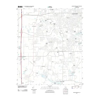
2011 Map of Warner Robins SW
USGS Topo · Published 2011About this map
Warner Robins expands across this landscape, where residential developments like Quail Run North and Sonja Heights meet the creek valleys of Houston County. The area is defined by its water management, featuring numerous named dams and reservoirs including Lake Joy Dam, Griffin Lake Dam, and Smith Lake Dam. These artificial water bodies, such as Lake Placid and Houston Lake, are interspersed among established neighborhoods and rural transitions.
Find a feature on this map
117 named features on this map. Tap any name to fly to it.
Don’t see what you’re looking for? This feature index may not catch every label — zoom into the map to look around manually.
Map Details
Editions of this 2011 Warner Robins SW Map
This is the sole edition of this map. No revisions or reprints were ever made.
Other maps of this area

1956 · Fort Valley
USGS Topo · 1:62,500

1956 · Perry
USGS Topo · 1:62,500

1956 · Warner Robins
USGS Topo · 1:62,500

1957 · Macon
USGS Topo · 1:250,000

1958 · Macon
USGS Topo · 1:250,000

1964 · Macon
USGS Topo · 1:250,000

1972 · Perry West
USGS Topo · 1:24,000

1973 · Hayneville
USGS Topo · 1:24,000

1973 · Warner Robins NE
USGS Topo · 1:24,000
1973 · Warner Robins SE
USGS Topo · 1:24,000