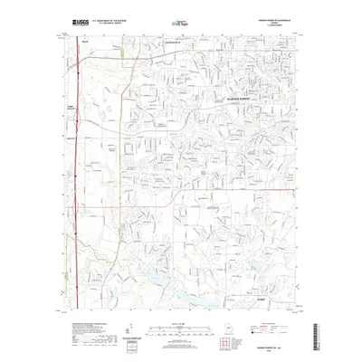
2020 Map of Warner Robins SW
USGS Topo · Published 2020About this map
Warner Robins and Centerville anchor this landscape during a period of significant suburban expansion along the boundary of Peach and Houston counties. The map captures the transition from open lands to dense residential developments, notably around Warner Robins Air Park and the Central Georgia Technical College. Local history and family genealogy are grounded in preserved sites such as the Leverett Family Cem and Lamar Cem, which remain as quiet witnesses to the area's rural past amidst the growing city grid. The southern portion of the sheet is defined by substantial water bodies including Lake Joy and Houston Lake, with Donelson Br and Sandy Run Creek threading through the terrain. Civic life is represented by the Houston County State Courthouse, while smaller pockets like Peachtree Landings and Lakeview highlight the 21st-century residential character of the region.
Find a feature on this map
384 named features on this map. Tap any name to fly to it.
Don’t see what you’re looking for? This feature index may not catch every label — zoom into the map to look around manually.
Map Details
Editions of this 2020 Warner Robins SW Map
This is the sole edition of this map. No revisions or reprints were ever made.
Other maps of this area

1956 · Fort Valley
USGS Topo · 1:62,500

1956 · Perry
USGS Topo · 1:62,500

1956 · Warner Robins
USGS Topo · 1:62,500

1957 · Macon
USGS Topo · 1:250,000

1958 · Macon
USGS Topo · 1:250,000

1964 · Macon
USGS Topo · 1:250,000

1972 · Perry West
USGS Topo · 1:24,000

1973 · Hayneville
USGS Topo · 1:24,000

1973 · Warner Robins NE
USGS Topo · 1:24,000
1973 · Warner Robins SE
USGS Topo · 1:24,000