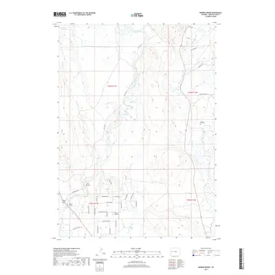
2017 Map of Warren Bridge
USGS Topo · Published 2017About this map
The Green River meanders southward through this Sublette County landscape, passing through a constriction known as The Narrows before reaching the river crossing at Warren Bridge. This 2017 study illustrates the intersection of historical cattle country and modern rural development, particularly in the subdivided area of Forty Rod Flat south of the river. The road network here is heavily influenced by the heritage of the West, featuring street names like Chief Joseph Rd, Sitting Bull Rd, and Eagle Feather Rd. East of the main river corridor, the terrain flattens toward the New Fork River, where the Alexander Family Cem serves as a small but significant landmark for genealogical researchers. Smaller drainages including Marsh Cr and Spring Cr feed the larger river system, tracing the natural hydrologic patterns of the high plains.
Find a feature on this map
39 named features on this map. Tap any name to fly to it.
Don’t see what you’re looking for? This feature index may not catch every label — zoom into the map to look around manually.
Map Details
Editions of this 2017 Warren Bridge Map
This is the sole edition of this map. No revisions or reprints were ever made.
Other maps of this area

1907 · Gros Ventre
USGS Topo · 1:125,000

1909 · Fremont Peak
USGS Topo · 1:125,000

1910 · Gros Ventre
USGS Topo · 1:125,000

1939 · Big Piney
USGS Topo · 1:125,000

1942 · Big Piney
USGS Topo · 1:125,000

1955 · Driggs
USGS Topo · 1:250,000

1955 · Preston
USGS Topo · 1:250,000

1955 · Thermopolis
USGS Topo · 1:250,000

1955 · Lander
USGS Topo · 1:250,000

1958 · Driggs
USGS Topo · 1:250,000