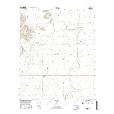
2016 Map of Warren
USGS Topo · Published 2016About this map
Warren serves as the primary settlement on this landscape, situated south of a dramatic bend in the North Fork Red River. The topography is defined by the stark transition from the river basin to the elevations of Soldiers Peak, Tepee Mtn, and Flat Top Mtn in the northwest. This area of Southwest Oklahoma is marked by its grid-based rural road network, which navigates around significant natural obstacles like Devils Canyon.
Find a feature on this map
41 named features on this map. Tap any name to fly to it.
Don’t see what you’re looking for? This feature index may not catch every label — zoom into the map to look around manually.
Map Details
Editions of this 2016 Warren Map
This is the sole edition of this map. No revisions or reprints were ever made.
Other maps of this area

1955 · Lawton
USGS Topo · 1:250,000

1963 · Babbs
USGS Topo · 1:24,000

1964 · Altus
USGS Topo · 1:24,000

1964 · Lone Wolf
USGS Topo · 1:24,000

1964 · Warren
USGS Topo · 1:24,000

1964 · Headrick
USGS Topo · 1:24,000
1964 · Roosevelt
USGS Topo · 1:24,000

1964 · Long Mountain
USGS Topo · 1:24,000

1971 · Blair
USGS Topo · 1:24,000

1971 · Lake Altus
USGS Topo · 1:24,000