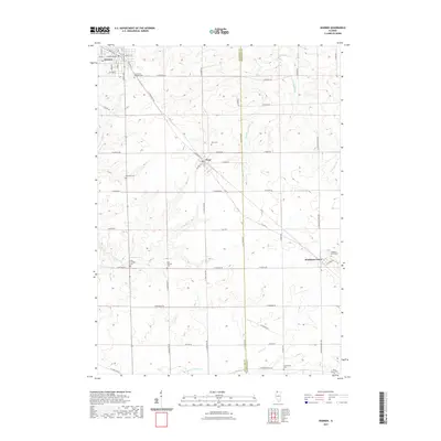
2021 Map of Warren
USGS Topo · Published 2021About this map
The town of Warren anchors the northwestern corner of this Jo Daviess County landscape, where the local street grid meets the winding path of Wolf Cr. Moving southeast, the terrain transitions into agricultural tracts defined by the settlements of Nora and Waddams Grove. This area is characterized by a high density of small, family and community burial sites that offer a fragmented map of early settlement patterns, including Saint Annes Catholic Cem near the town center and more isolated locations like Howardville Cem and Holly Grove Cem. The drainage of the S Fork Apple River and Spafford Cr carves through the undulating topography, dictating the placement of rural roads like N Stagecoach Trl. The map reflects a modern state of long-established Midwestern townships where the boundary between Jo Daviess and Stephenson counties bisects the rural landscape.
Find a feature on this map
63 named features on this map. Tap any name to fly to it.
Don’t see what you’re looking for? This feature index may not catch every label — zoom into the map to look around manually.
Map Details
Editions of this 2021 Warren Map
This is the sole edition of this map. No revisions or reprints were ever made.
Other maps of this area

1902 · Mineral Point
USGS Topo · 1:125,000

1911 · Elizabeth
USGS Topo · 1:62,500

1923 · South Wayne
USGS Topo · 1:62,500

1936 · Elizabeth
USGS Topo · 1:62,500

1937 · Lena
USGS Topo · 1:48,000

1942 · Lena
USGS Topo · 1:62,500

1943 · Lena
USGS Topo · 1:62,500

1954 · Rockford
USGS Topo · 1:250,000

1955 · Rockford
USGS Topo · 1:250,000

1958 · Rockford
USGS Topo · 1:250,000