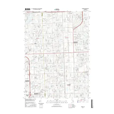
2017 Map of Warren
USGS Topo · Published 2017About this map
Warren and Sterling Heights anchor this 2017 survey, revealing the dense suburban expansion and complex water management systems of southern Macomb County. The landscape is defined by an intricate network of engineered drainage, including the Gamble Drain, Moore Drain, and Gibson Drain, which channel water toward natural arteries like the Clinton River and Bear Cr. These features reflect the region's mid-century transformation from farmland into a major residential and industrial hub.
Find a feature on this map
60 named features on this map. Tap any name to fly to it.
Don’t see what you’re looking for? This feature index may not catch every label — zoom into the map to look around manually.
Map Details
Editions of this 2017 Warren Map
This is the sole edition of this map. No revisions or reprints were ever made.
Other maps of this area

1905 · Detroit
USGS Topo · 1:62,500

1905 · Grosse Pointe
USGS Topo · 1:62,500

1908 · Rochester
USGS Topo · 1:62,500

1912 · Mt Clemens
USGS Topo · 1:62,500

1918 · Detroit
USGS Topo · 1:62,500

1918 · Grosse Pointe
USGS Topo · 1:62,500

1924 · Detroit
USGS Topo · 1:62,500

1929 · Mt Clemens
USGS Topo · 1:62,500

1934 · Detroit
USGS Topo · 1:62,500

1936 · Warren
USGS Topo · 1:31,680