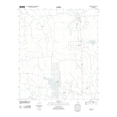
2010 Map of Warren
USGS Topo · Published 2010About this map
Warren serves as a central hub in this Southeast Texas landscape, situated where the terrain transitions toward the drainage of Hickory Creek. The 2010 survey highlights the established residential character of Wildwood, which surrounds Lake Kimball in the southern portion of the quadrangle. This area reveals a legacy of resource extraction, evidenced by the Pavey Oil Field and the West Village Mills Oil Field, which speak to the industrial underpinnings of Tyler County. For genealogists, the map provides precise locations for several local burial grounds, including Fellowship Cemetery, Warren Cemetery, and Village Mills Cemetery. Water dominates the eastern and southern edges with Big Sandy Creek and Village Creek carving through the piney woods, while landmarks like Hyatt Lookout and Hyatt Lake Dam reflect more modern infrastructure and management of the local topography.
Find a feature on this map
41 named features on this map. Tap any name to fly to it.
Don’t see what you’re looking for? This feature index may not catch every label — zoom into the map to look around manually.
Map Details
Editions of this 2010 Warren Map
This is the sole edition of this map. No revisions or reprints were ever made.
Other maps of this area

1943 · Liberty
USGS Topo · 1:125,000

1954 · Beaumont
USGS Topo · 1:250,000

1955 · Saratoga
USGS Topo · 1:62,500

1955 · Kountze
USGS Topo · 1:62,500

1957 · Beaumont
USGS Topo · 1:250,000

1958 · Segno
USGS Topo · 1:62,500

1958 · Warren
USGS Topo · 1:62,500

1984 · Beaumont
USGS Topo · 1:250,000

1984 · Jacks Creek South
USGS Topo · 1:24,000

1984 · Jacks Creek North
USGS Topo · 1:24,000