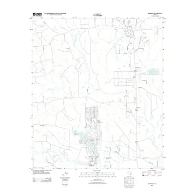
2013 Map of Warren
USGS Topo · Published 2013About this map
Warren and the residential corridors of Wildwood anchor this landscape in Tyler County, which is defined by a dense network of forest roads and creek-bottom drainage. The map reveals a community deeply connected to local geography and resource extraction, evidenced by the Pavey Oil Field and the West Village Mills Oil Field along the southern edge. Hydrology is central to the area's layout, with Big Sandy Cr, Hickory Cr, and Black Cr winding through the terrain. Cultural landmarks for genealogists and local historians are well-preserved, including the Warren Cem, Fellowship Cem, and Village Mills Cem. Aviation and observation are represented by the Wildwood Airport and the elevated Hyatt Lookout, while Hyatt Lake provides a notable water feature near the settlement of Hyatt.
Find a feature on this map
101 named features on this map. Tap any name to fly to it.
Don’t see what you’re looking for? This feature index may not catch every label — zoom into the map to look around manually.
Map Details
Editions of this 2013 Warren Map
This is the sole edition of this map. No revisions or reprints were ever made.
Other maps of this area

1943 · Liberty
USGS Topo · 1:125,000

1954 · Beaumont
USGS Topo · 1:250,000

1955 · Saratoga
USGS Topo · 1:62,500

1955 · Kountze
USGS Topo · 1:62,500

1957 · Beaumont
USGS Topo · 1:250,000

1958 · Segno
USGS Topo · 1:62,500

1958 · Warren
USGS Topo · 1:62,500

1984 · Beaumont
USGS Topo · 1:250,000

1984 · Jacks Creek South
USGS Topo · 1:24,000

1984 · Jacks Creek North
USGS Topo · 1:24,000