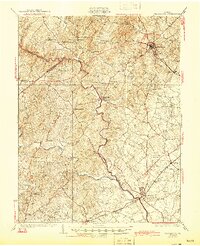
1930 Map of Warrenton
USGS Topo · Published 1945About this map
The Rappahannock River carves a winding path through this Piedmont landscape, serving as the boundary between Fauquier and Culpeper counties. In the northeast, the town of Warrenton stands as a significant regional hub, where a network of early roads and the Southern railroad branch converge. The map documents a rural economy defined by small crossroads communities and family-named landmarks.
Find a feature on this map
62 named features on this map. Tap any name to fly to it.
Don’t see what you’re looking for? This feature index may not catch every label — zoom into the map to look around manually.
Map Details
Editions of this 1930 Warrenton Map
2 editions found
Other maps of this area

1887 · Spottsylvania
USGS Topo · 1:125,000

1892 · Spottsylvania
USGS Topo · 1:125,000

1892 · Gordonsville
USGS Topo · 1:125,000

1893 · Luray
USGS Topo · 1:125,000

1894 · Warrenton
USGS Topo · 1:125,000

1894 · Warrenton
USGS Topo · 1:62,500

1905 · Luray
USGS Topo · 1:125,000

1927 · Remington
USGS Topo · 1:48,000

1930 · Warrenton
USGS Topo · 1:62,500

1933 · Middleburg
USGS Topo · 1:62,500