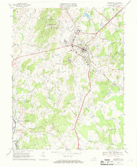
1966 Map of Warrenton
USGS Topo · Published 1968About this map
Warrenton serves as a prominent hub in this 1960s study, where the intersection of traditional Piedmont agriculture and Cold War infrastructure is clearly visible. The town center is surrounded by specialized facilities like Fauquier Hospital, Taylor High Sch, and several radio towers including Radio Tower (WEER). To the west, the Warrenton Training Center occupies a large tract near Viewtree Mtn, highlighting the area's strategic importance during the era.
Find a feature on this map
46 named features on this map. Tap any name to fly to it.
Don’t see what you’re looking for? This feature index may not catch every label — zoom into the map to look around manually.
Map Details
Editions of this 1966 Warrenton Map
4 editions found
Other maps of this area

1894 · Warrenton
USGS Topo · 1:125,000

1894 · Warrenton
USGS Topo · 1:62,500

1927 · Remington
USGS Topo · 1:48,000

1930 · Warrenton
USGS Topo · 1:62,500

1933 · Middleburg
USGS Topo · 1:62,500

1943 · Catlett
USGS Topo · 1:62,500

1943 · Thorofare Gap
USGS Topo · 1:24,000

1943 · Orlean
USGS Topo · 1:24,000

1943 · Midland
USGS Topo · 1:24,000

1943 · Marshall
USGS Topo · 1:24,000