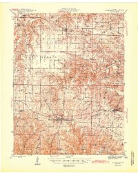
1945 Map of Warrenton
USGS Topo · Published 1945About this map
The Wabash railroad corridor anchors the southern half of this mid-1940s landscape, connecting the growing hubs of Warrenton, Truesdale, and Wright City. This area is characterized by a high concentration of rural educational and spiritual centers, reflecting a well-established community structure where one-room schoolhouses like Goat Spring Sch and Locust Grove Sch served local farm families. Further north, the Chicago Burlington and Quincy line passes through Hawk Point, linking the agricultural prairie to broader markets.
Find a feature on this map
80 named features on this map. Tap any name to fly to it.
Don’t see what you’re looking for? This feature index may not catch every label — zoom into the map to look around manually.
Map Details
Editions of this 1945 Warrenton Map
2 editions found

Other maps of this area

1890 · Louisiana
USGS Topo · 1:125,000

1890 · Hermann
USGS Topo · 1:125,000

1903 · O'Fallon
USGS Topo · 1:125,000

1934 · Elsberry
USGS Topo · 1:48,000

1936 · Hermann
USGS Topo · 1:48,000

1937 · Silex
USGS Topo · 1:62,500

1939 · Silex
USGS Topo · 1:48,000

1941 · Troy
USGS Topo · 1:62,500

1942 · Elsberry
USGS Topo · 1:62,500

1942 · Hermann
USGS Topo · 1:62,500