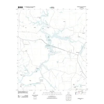
2011 Map of Warrior Dam
USGS Topo · Published 2011About this map
The Black-Warrior River carves a winding path through this portion of Greene County, defining a landscape shaped by river navigation and rural transit. Numerous family-named bluffs and bars, such as Browns Bluff, Samples Bluff, and Choctaw Bar, point to the long history of riverine commerce and travel along these banks. The transition from traditional river crossings to modern infrastructure is evident in landmarks like Eutaw Landing and Jennings Ferry Point, juxtaposed with the Oscar Underwood Bridge and the Howard Brown Dam.
Find a feature on this map
76 named features on this map. Tap any name to fly to it.
Don’t see what you’re looking for? This feature index may not catch every label — zoom into the map to look around manually.
Map Details
Editions of this 2011 Warrior Dam Map
This is the sole edition of this map. No revisions or reprints were ever made.
Other maps of this area

1927 · Eutaw
USGS Topo · 1:48,000

1931 · Eutaw
USGS Topo · 1:62,500

1947 · Mason Bend
USGS Topo · 1:24,000

1947 · Forkland
USGS Topo · 1:24,000

1948 · Mason Bend
USGS Topo · 1:24,000

1949 · Forkland
USGS Topo · 1:24,000

1953 · Montgomery
USGS Topo · 1:250,000

1956 · Montgomery
USGS Topo · 1:250,000

1957 · Montgomery
USGS Topo · 1:250,000
1980 · Union
USGS Topo · 1:24,000