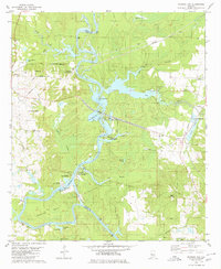
1980 Map of Warrior Dam
USGS Topo · Published 1980About this map
The Black Warrior River Lake and its intricate system of navigation locks dominate this 1980 survey of the border between Greene and Hale Counties. The landscape is defined by the heavy engineering of the Warrior Lock and Dam, which controls the water levels for river traffic. The river creates dramatic loops like Choctaw Bend and Choctaw Bluff, while surrounding lowlands are marked by Cypress Swamp and Grinnel Pond.
Find a feature on this map
55 named features on this map. Tap any name to fly to it.
Don’t see what you’re looking for? This feature index may not catch every label — zoom into the map to look around manually.
Map Details
Editions of this 1980 Warrior Dam Map
This is the sole edition of this map. No revisions or reprints were ever made.
Other maps of this area

1927 · Eutaw
USGS Topo · 1:48,000

1931 · Eutaw
USGS Topo · 1:62,500

1947 · Mason Bend
USGS Topo · 1:24,000

1947 · Forkland
USGS Topo · 1:24,000

1948 · Mason Bend
USGS Topo · 1:24,000

1949 · Forkland
USGS Topo · 1:24,000

1953 · Montgomery
USGS Topo · 1:250,000

1956 · Montgomery
USGS Topo · 1:250,000

1957 · Montgomery
USGS Topo · 1:250,000
1980 · Union
USGS Topo · 1:24,000