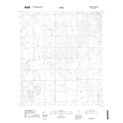
2021 Map of Warrior Swamp
USGS Topo · Published 2021About this map
Warrior Swamp and White Oak Swamp dominate this Taylor County landscape, reflecting the intricate hydrology of the Florida Gulf Coast. The region is defined by a complex network of wetlands and small water bodies, including Cypress Lake, Bear Harbor Lake, and George Ann Lake. This survey illustrates a quiet, rural area where transportation is primarily dictated by a grid of local routes like Keaton Beach Rd and the Josh Ezell Grade.
Find a feature on this map
70 named features on this map. Tap any name to fly to it.
Don’t see what you’re looking for? This feature index may not catch every label — zoom into the map to look around manually.
Map Details
Editions of this 2021 Warrior Swamp Map
This is the sole edition of this map. No revisions or reprints were ever made.
Other maps of this area

1954 · Fenholloway
USGS Topo · 1:24,000

1954 · Salem SW
USGS Topo · 1:24,000

1954 · Warrior Swamp
USGS Topo · 1:24,000

1954 · Salem
USGS Topo · 1:24,000

1954 · Hampton Springs
USGS Topo · 1:24,000

1954 · Keaton Beach
USGS Topo · 1:24,000

1954 · Okefenokee Slough
USGS Topo · 1:24,000

1954 · Gainesville
USGS Topo · 1:250,000

1954 · Valdosta
USGS Topo · 1:250,000

1955 · Perry
USGS Topo · 1:24,000