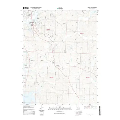
2015 Map of Warsaw East
USGS Topo · Published 2015About this map
Lake of the Ozarks and the Harry S Truman Reservoir dominate the landscape of Benton County, Missouri, where these massive water bodies converge near the community of Warsaw. This survey illustrates the intricate network of tributaries and hollows that define the region's topography, including White Branch, Blue Branch, and Scott Hollow. The map reveals a pattern of dispersed rural settlements and local junctions like Gabriels Mills, Dell Junction, and Majorville. For genealogists and local historians, the sheet is particularly valuable for its documentation of numerous burial sites, including Turkey Creek Cemetery, New Home Cemetery, and Vance Cemetery. These features, combined with the presence of local roads such as Lickingteller Ave and All American Way, provide a clear view of the area's modern infrastructure set against its traditional rural roots.
Find a feature on this map
105 named features on this map. Tap any name to fly to it.
Don’t see what you’re looking for? This feature index may not catch every label — zoom into the map to look around manually.
Map Details
Editions of this 2015 Warsaw East Map
This is the sole edition of this map. No revisions or reprints were ever made.
Other maps of this area

1887 · Warsaw
USGS Topo · 1:125,000

1894 · Warsaw
USGS Topo · 1:125,000

1935 · Edwards
USGS Topo · 1:24,000

1935 · Dell
USGS Topo · 1:24,000

1936 · Shawnee Bend
USGS Topo · 1:24,000

1936 · Lakeview Heights
USGS Topo · 1:24,000

1936 · Schuyler
USGS Topo · 1:24,000

1945 · Fristoe
USGS Topo · 1:62,500

1947 · Jefferson City
USGS Topo · 1:250,000

1954 · Jefferson City
USGS Topo · 1:250,000