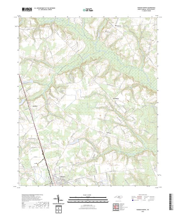
2022 Map of Warsaw North
USGS Topo · Published 2022About this map
Warsaw serves as the primary urban center for this Duplin County landscape, where the grid of streets like N Front St and W Chelly St meets the rural agricultural surrounding. The terrain is defined by a dense network of slow-moving drainage systems, most notably the wide Goshen Swamp and Bear Swamp which weave between small community clusters. Smaller settlements like Beautancus, Bowdens, and Friendship are connected by a web of family-named roads such as Bill Clifton Rd and Robert Hobbs Rd, reflecting long-standing local ties to the land. The presence of features like the Larry McCullen Pond near Silver Lake and various smaller branches including Nahunga Cr and Horsepen Br illustrates the watery nature of the coastal plain, where drainage and elevation dictate the historical placement of homes and industry.
Find a feature on this map
93 named features on this map. Tap any name to fly to it.
Don’t see what you’re looking for? This feature index may not catch every label — zoom into the map to look around manually.
Map Details
Editions of this 2022 Warsaw North Map
This is the sole edition of this map. No revisions or reprints were ever made.
Other maps of this area

1943 · Kenansville
USGS Topo · 1:62,500

1948 · Kenansville
USGS Topo · 1:62,500

1953 · Florence
USGS Topo · 1:250,000

1953 · Rocky Mount
USGS Topo · 1:250,000

1953 · Raleigh
USGS Topo · 1:250,000

1953 · Beaufort
USGS Topo · 1:250,000

1954 · Rocky Mount
USGS Topo · 1:250,000

1954 · Florence
USGS Topo · 1:250,000

1954 · Raleigh
USGS Topo · 1:250,000

1954 · Beaufort
USGS Topo · 1:250,000