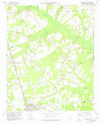
1977 Map of Warsaw North
USGS Topo · Published 1977About this map
Warsaw anchors the southern edge of this mid-1970s survey, showing a landscape defined by the intersection of the Seaboard Coast Line railroad and a network of agricultural communities. The terrain is structured by the broad, wooded reaches of Goshen Swamp and Nahunga Creek, which drain the surrounding farmland. Smaller hamlets like Beautancus, Bowdens, and Friendship are mapped in detail, each serving as a local hub with its own country churches such as St Johns Ch and Friendship Ch. The presence of an Old RR Grade running toward the southeast and a dedicated Landing Strip near the railroad tracks reflects the area's evolving transportation infrastructure. Cultural markers are dense throughout the quadrangle, including numerous Cem sites and the Warsaw Jr High Sch, providing a clear look at the rural social fabric of Duplin County during this era.
Find a feature on this map
37 named features on this map. Tap any name to fly to it.
Don’t see what you’re looking for? This feature index may not catch every label — zoom into the map to look around manually.
Map Details
Editions of this 1977 Warsaw North Map
This is the sole edition of this map. No revisions or reprints were ever made.
Other maps of this area

1943 · Kenansville
USGS Topo · 1:62,500

1948 · Kenansville
USGS Topo · 1:62,500

1953 · Florence
USGS Topo · 1:250,000

1953 · Rocky Mount
USGS Topo · 1:250,000

1953 · Raleigh
USGS Topo · 1:250,000

1953 · Beaufort
USGS Topo · 1:250,000

1954 · Rocky Mount
USGS Topo · 1:250,000

1954 · Florence
USGS Topo · 1:250,000

1954 · Raleigh
USGS Topo · 1:250,000

1954 · Beaufort
USGS Topo · 1:250,000