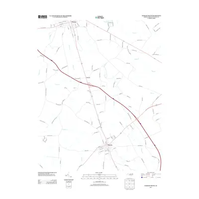
2013 Map of Warsaw South
USGS Topo · Published 2013About this map
Warsaw anchors the northern boundary of this Duplin County survey, where the grid of W Plank Rd and S Railroad St reflects its deep ties to the regional transportation network. Moving south along the corridor toward the town of Magnolia, the landscape transitions into a complex drainage system defined by Stewarts Cr, Maxwell Cr, and Millers Cr. The rural settlement of Carroll sits between these two centers, situated near the headwaters of several local branches. The proximity of Silver Lake and the various creeks like Buckhall Cr and Grove Cr suggests a terrain historically shaped by its proximity to the coastal plain's watercourses. This map documents the persistent agricultural and transit patterns of the eastern North Carolina landscape as they stood in the early twenty-first century.
Find a feature on this map
114 named features on this map. Tap any name to fly to it.
Don’t see what you’re looking for? This feature index may not catch every label — zoom into the map to look around manually.
Map Details
Editions of this 2013 Warsaw South Map
This is the sole edition of this map. No revisions or reprints were ever made.
Other maps of this area

1943 · Kenansville
USGS Topo · 1:62,500

1948 · Kenansville
USGS Topo · 1:62,500

1953 · Florence
USGS Topo · 1:250,000

1953 · Rocky Mount
USGS Topo · 1:250,000

1953 · Raleigh
USGS Topo · 1:250,000

1953 · Beaufort
USGS Topo · 1:250,000

1954 · Rocky Mount
USGS Topo · 1:250,000

1954 · Florence
USGS Topo · 1:250,000

1954 · Raleigh
USGS Topo · 1:250,000

1954 · Beaufort
USGS Topo · 1:250,000