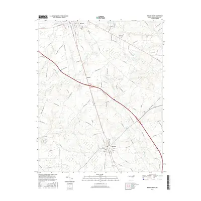
2016 Map of Warsaw South
USGS Topo · Published 2016About this map
Warsaw and Magnolia anchor this Duplin County landscape, illustrating a classic North Carolina coastal plain settlement pattern shaped by early rail and road corridors. The geographic heart of the map features the smaller community of Carroll, while the county seat of Kenansville appears on the eastern edge. This area is defined by a dense network of black-water drainages, including Stewarts Cr, Buckhall Cr, and Millers Cr, which influenced the placement of early infrastructure like Beasleys Mill Rd. Local heritage is preserved in sites such as Pine Crest Cem and Rose Hill Cem, alongside more modern landmarks like the Devotional Gardens. The numerous family-named routes, such as Jesse Williams Rd and Charlie Frederick Rd, provide a window into the landholding history and genealogical fabric of the rural townships between the established railroad towns.
Find a feature on this map
117 named features on this map. Tap any name to fly to it.
Don’t see what you’re looking for? This feature index may not catch every label — zoom into the map to look around manually.
Map Details
Editions of this 2016 Warsaw South Map
This is the sole edition of this map. No revisions or reprints were ever made.
Other maps of this area

1943 · Kenansville
USGS Topo · 1:62,500

1948 · Kenansville
USGS Topo · 1:62,500

1953 · Florence
USGS Topo · 1:250,000

1953 · Rocky Mount
USGS Topo · 1:250,000

1953 · Raleigh
USGS Topo · 1:250,000

1953 · Beaufort
USGS Topo · 1:250,000

1954 · Rocky Mount
USGS Topo · 1:250,000

1954 · Florence
USGS Topo · 1:250,000

1954 · Raleigh
USGS Topo · 1:250,000

1954 · Beaufort
USGS Topo · 1:250,000