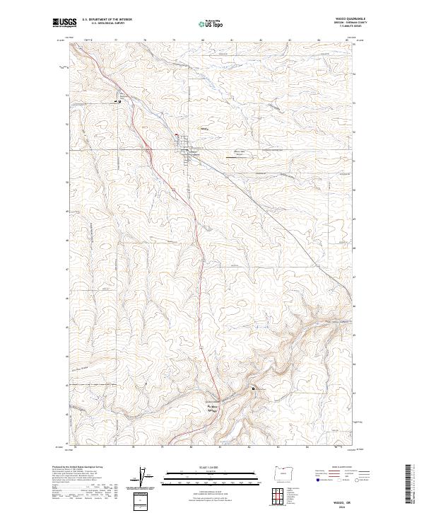
2024 Map of Wasco
USGS Topo · Published 2024About this map
Wasco serves as the primary hub in this Sherman County landscape, where the town’s grid is defined by streets such as Armsworthy St and Fulton St. The surrounding geography is deeply incised by complex drainage patterns, including China Hollow, Spanish Hollow, and Grass Valley Canyon. These natural features dictated the early transportation routes, now reflected in the winding paths of the Old Sherman Hwy and the Old Wasco-Heppner Hwy.
Find a feature on this map
47 named features on this map. Tap any name to fly to it.
Don’t see what you’re looking for? This feature index may not catch every label — zoom into the map to look around manually.
Map Details
Editions of this 2024 Wasco Map
This is the sole edition of this map. No revisions or reprints were ever made.
Other maps of this area

1953 · The Dalles
USGS Topo · 1:250,000

1956 · The Dalles
USGS Topo · 1:250,000

1957 · The Dalles
USGS Topo · 1:250,000

1957 · Wasco
USGS Topo · 1:62,500

1957 · Wishram
USGS Topo · 1:62,500

1962 · Erskine
USGS Topo · 1:24,000

1971 · Moro
USGS Topo · 1:24,000

1971 · Quinton
USGS Topo · 1:24,000
1971 · Klondike
USGS Topo · 1:24,000
1971 · Harmony
USGS Topo · 1:24,000